⌖
IN DEVELOPMENT · SOFTWARE PROTOTYPE
Offline maps & GPS navigation
Keep map data on the device, save waypoints, and work toward fully offline turn-by-turn navigation.
 DOWNLOAD
One portable field station for mapping, navigation, wireless discovery, and radio-frequency observations. Built to work beyond the reach of a cell signal.
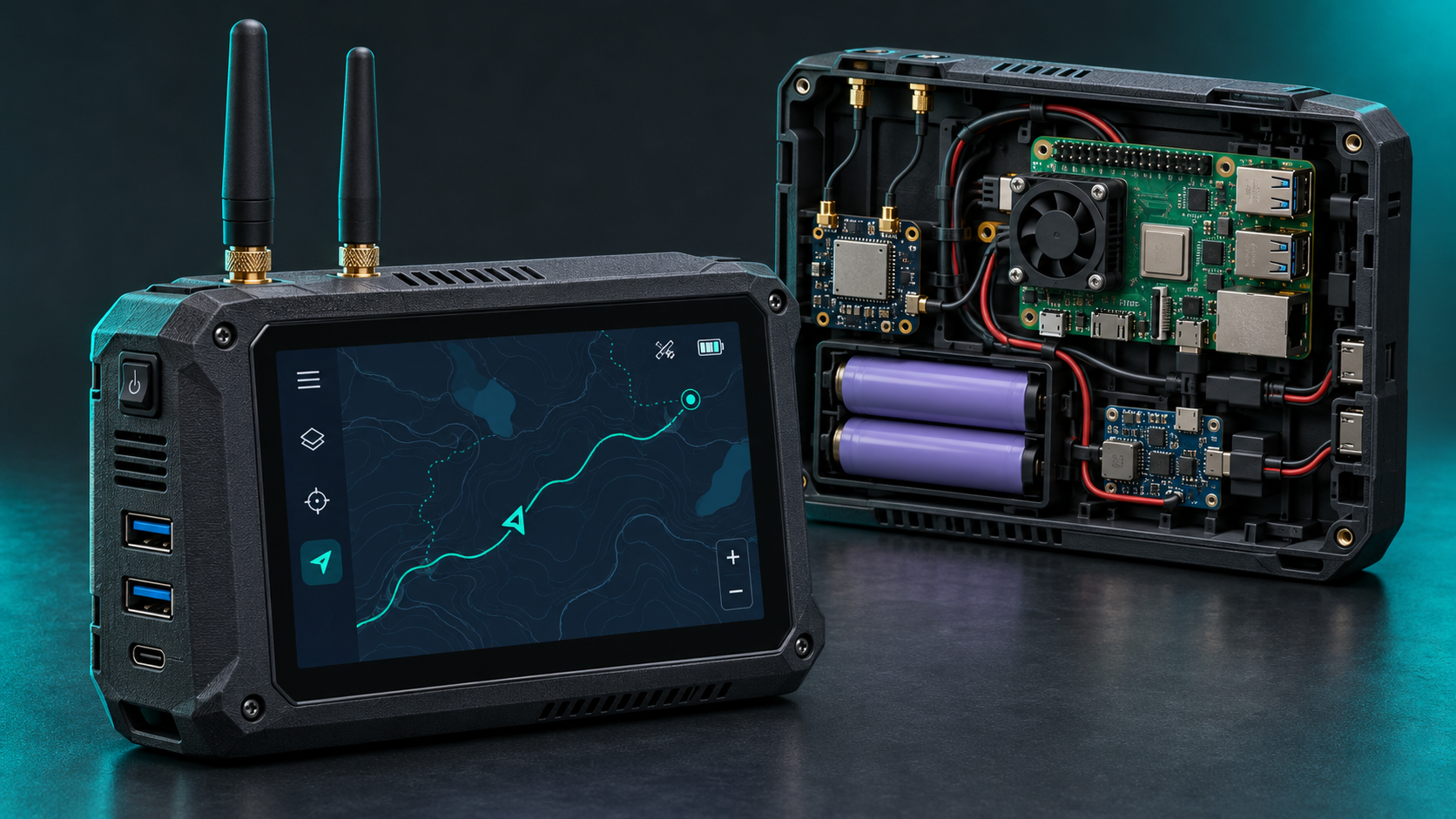
OpenRF brings different field tools into one unified interface. Features are labeled by development status—because a planned sensor is not the same as a working one.
Keep map data on the device, save waypoints, and work toward fully offline turn-by-turn navigation.
Record supported wireless observations with compatible Linux adapters and clear device capability reporting.
Capture time-stamped notes and GPS-linked evidence locally, with export for later review.
Optional SDR modules for spectrum viewing and signal characterization within their actual supported bands.
Explore LoRa, RNode, Reticulum, and optional Wi-Fi HaLow for resilient local and long-range links.
Optional dedicated police-radar detection, infrared, sub-GHz, and cellular observation hardware.
No cloud account required. OpenRF is designed around locally stored maps, observations, and sessions. Connect to Wi-Fi when you want updates or internet access—not because the app needs permission to work.
VIEW DEVELOPMENT ROADMAPMaps and records designed for disconnected use.
Add receivers and sensors as your hardware grows.
Clearly identified real, historical, and demo readings.
Local data by default. No automatic uploads.
Start with the essentials. Add radio and sensing modules when you need them. The exact parts list, fit, power draw, and wiring will be finalized as real hardware is tested.
Main Linux computer and software host.
Compact landscape display; ~800 × 480 design target.
GPS position for navigation and field observations.
Appropriately rated 18650 pack, BMS, regulation, and safe charging design.
Space for the screen, Pi, power system, antennas, and future expansions.
Optional general RF reception and spectrum exploration.
Future Reticulum-compatible long-range messaging expansion.
Potential long-range IP networking; chipset and Linux driver selection pending.
For hardware-dependent Linux discovery and measurements.
Dedicated X/K/Ka hardware and optional optical sensors in a future build.
These are technical reference links, not affiliate storefront listings. No parts are claimed to be tested together yet. Prices, availability, and battery-system choices are intentionally not assumed.
A practical assembly sequence. This is a planning guide while the final enclosure, electronics, and battery wiring are being validated.
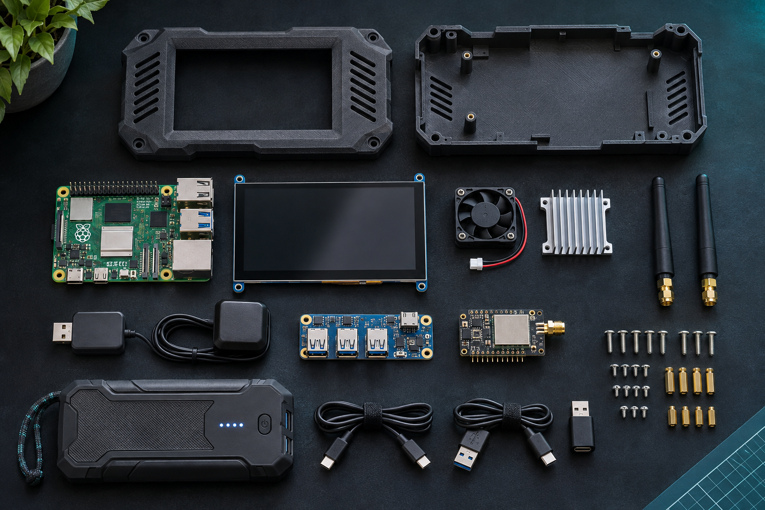
Pick your Raspberry Pi, 5-inch display, storage, and GPS receiver. Confirm port counts, cooling, and the space reserved for future modules.
Parts inventory: compute, screen, GPS, enclosurePLANInstall Raspberry Pi OS, start OpenRF locally, connect the display, and verify GPS and any supported adapters individually.
Check the display, OS and peripherals before mountingSOFTWAREMeasure actual load and standby draw, choose a protected rechargeable power solution, and verify thermal behavior. Do not assemble an unprotected DIY lithium pack.
Use a rated, protected power solutionSAFETYLay out mounting points, ventilation, cable routing, accessible connectors, screen opening, and strain-relieved antenna pass-throughs.
Check mount points, clearances and ventilationASSEMBLYConnect supported RF, mesh, and wireless peripherals and verify they report accurate hardware identity and status in OpenRF.
Add one supported module and verify its statusEXPANDConfirm offline map use, GPS accuracy, operating time, heat, and data exports before treating the device as field-ready.
Test GPS, offline use, heat and battery runtimeTESTBuild documentation is evolving. Exact wiring diagrams, tested part numbers, enclosure files, and battery specifications will be added only after validation. Never connect raw lithium cells directly to a Raspberry Pi.
We’re developing the Linux software first, then integrating a real self-contained Raspberry Pi prototype.
Local UI, offline records, maps, wireless discovery, and early messaging prototypes.
RNode/Reticulum expansion, robust offline GPS routing, and better sensor integration.
Tested enclosure, battery power, touchscreen, modular receivers, and field endurance.
Maybe one day: assembled OpenRF devices or enclosure kits. There is no store or preorder today.
A more concrete look at the features we're working toward. Status describes project plans and software work, not proof that physical hardware has been tested.
Finish local routing engine integration, turn-by-turn guidance, and handling of missing routes.
IN PROGRESS / TESTINGLink observations to real GPS fixes, accuracy and timestamp age; review historical measurement maps.
PLANNED EXPANSIONSeparate ALPR/Flock and traffic-enforcement cameras, with sourced status and opt-in driving alerts.
PLANNED EXPANSIONPrepare reproducible Linux packages, installation instructions, checksums, and an open-source license.
RELEASE PREPARATIONImprove message delivery, LoRa hardware compatibility, relays and useful link diagnostics.
IN DEVELOPMENTEvaluate Linux adapters, driver detection, link status, and integration with mesh software.
IN DEVELOPMENTImprove real scanner measurements and add optional SDR spectrum tools as compatible devices arrive.
STAGED HARDWARE WORKSupport channel reference/import workflows for compatible radios, including CHIRP integration.
PLANNEDValidate 5-inch touchscreen, enclosures, cooling, USB expansion and accessible antenna ports.
HARDWARE DESIGNMeasure actual load and standby draw before choosing a safely protected battery system.
PLANNED VALIDATIONExplore dedicated radar detection, optical/IR and sub-GHz modules with documented limitations.
LONGER TERMReplace concept renders with actual part numbers, assembly photos and measured fit diagrams.
AFTER PROTOTYPE TESTINGFree, open-source, local-first software with a modular path from desktop development to a truly portable field device.
BACK TO TOP